My work has largely focused on how landscapes have responded to climate variability in the past, and how understanding this change can inform our expectations for landscape change on a warming planet. I’ve used physical, geochemical, and biological analysis of lake sediment cores to address this question. Building a history of environmental change from a lake basin can show if the site was sensitive to local and global climate events.
Projects I’ve worked on in North America include:
Glacial-interglacial cycles in subalpine Southern California
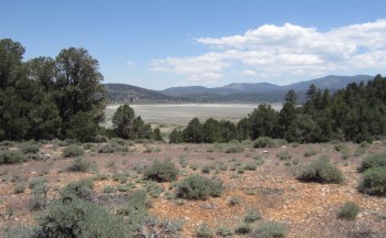
Overlooking the Baldwin Lake basin from an ice-age pebble plain, May 2014
For my Ph.D. research, I developed a ~125,000 year old lake history with multi-proxy analyses. Baldwin Lake is a sensitive site in the San Bernardino Mountains, right at the transition between mediterrean and desert biomes. Analyses showed high amplitude changes in lake level, moisture availability, erosion, wildfire, and forest structure. I proposed that summer insolation and North Atlantic warming were likely climatic drivers in Southern California’s mountains prior to the Last Glacial Maximum (Glover et al., 2017, QSR). Pollen and charcoal data showed a complex history of forest-shrubland shifts and wildfire that were likely driven by shifting Pacific sea surface temperatures, solar radiation, and hydrologic variability that operated on decadal-to-millennial scales (Glover et al., 2020, Paleoceanography and Paleoclimatology).
Data resources for the ~27 m Baldwin Lake core:
Pollen data at the Neotoma Paleoecology Database
Sediment, charcoal, and geochemical data at the NOAA National Centers for Environmental Information
Glover et al. (2017) QSR data supplement [.xls file]
Last updated Jul 2019
BDL12 sed/strat short summary [.pdf]
BDL12 sampling guide [.xls file] For sampling, cores are archived at the Univ of Minnesota.
BDL12 photos and descriptions [.zip file]
The Kankakee Paleo Project
The Grand Kankakee Marsh once covered 1000 mi2 of northwestern Indiana and was known as the “Everglades of the North” for its rich biodiversity. Late 19th century resource exploitation and drainage included channelizing the Kankakee River, irreversibly disturbing the Marsh. How has deposition and vegetation varied across the Kankakee Marsh over millennia in response to climate change? My approach to this question involved a field campaign to northwestern Indiana in June 2019 with students, funded by the National Geographic Society. Students developed capstone projects of their own, and in Spring 2020, an interactive map of land-use change and geography K-12 curriculum on our results will be developed.
This project has a separate page with research updates, datasets, and outreach materials. Please visit!
Timing of Midwest Deglaciation
I had my start in lake coring and analysis while pursuing my M.S. at the University of Cincinnati. Radiocarbon ages from a series of small-basin cores throughout Ohio and Indiana showed that landscape exposure (and therefore deglaciation) occurred within 2-3,000 years of the ice sheet’s maximum extent, earlier and faster than previously believed (Glover et al., 2011, Quaternary Research).
Glover et al. (2011) Ohio-Indiana radiocarbon data [.csv file]
includes a few corrections since publication
My animation of Ohio-Indiana deglaciation, visualizing retreat of the ice margin (based on Dyke, 2004) and exposure of these small basins:
